AIT: Hammer-Aitoff
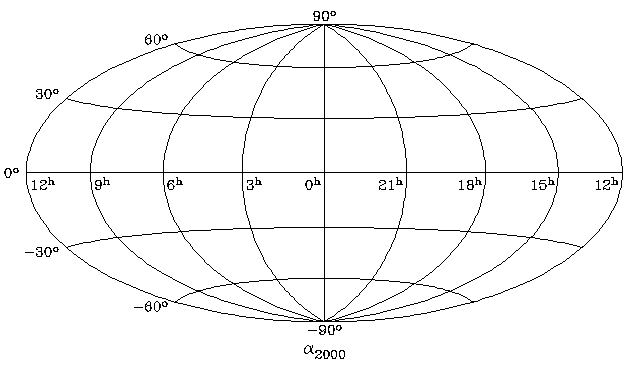
This equal area projection shows an entire sphere and is similar to the zenithal equal area projection, centered on the equator and rescaled to cover twice as much equatorial distance as polar distance. This projection was used for the all-sky maps produced by IRAS, the InfraRed Astronomy Satellite.
SIMPLE = T / file does conform to FITS standard BITPIX = -32 / number of bits per data pixel NAXIS = 2 / number of data axes NAXIS1 = 360 / length of data axis 1 NAXIS2 = 180 / length of data axis 2 CTYPE1 = 'RA---AIT' CTYPE2 = 'DEC--AIT' CRPIX1 = 180.5 / reference pixel CRPIX2 = 90.5 / reference pixel CRVAL1 = 0.0 / reference pixel value CRVAL2 = 0.0 / reference pixel value CDELT1 = -1.0 / degrees/pixel CDELT2 = 1.0 / degrees/pixel[World Coordinate Systems] [FITS World Coordinate Systems] [AIPS World Coordinate Systems]